converser.nz
-
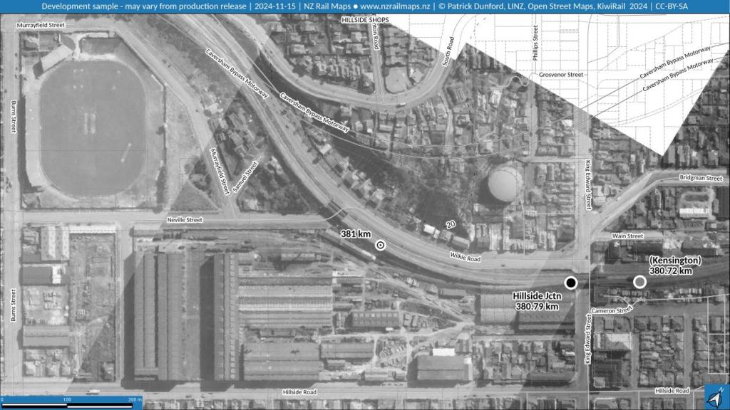
New Zealand Rail Maps: NZRM Progress Report 2024-11-15: Volume 10, Volume 12, Webmaps
Apologies for the long delay since the last update. October was not an auspicious month for map work for numerous reasons, and work had to be paused for practically the whole month whilst a number of issues were worked through. These have now been overcome, and production has resumed. For the rest of 2024 there…
-
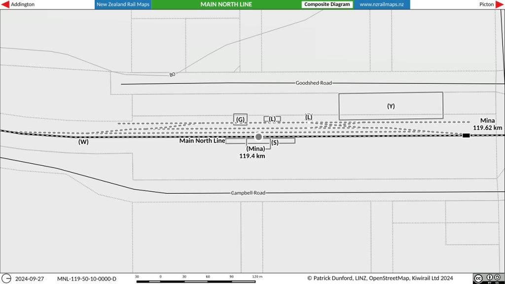
New Zealand Rail Maps: Mina Station, Main North Line
Mina is a small rural locality on the Main North Line at 119.4 km. It was formerly the railway station for the Cheviot township. The section of railway it is located from was formerly known as the Cheviot Branch because at that time, the main line was the route via the Weka Pass to Waiau.…
-
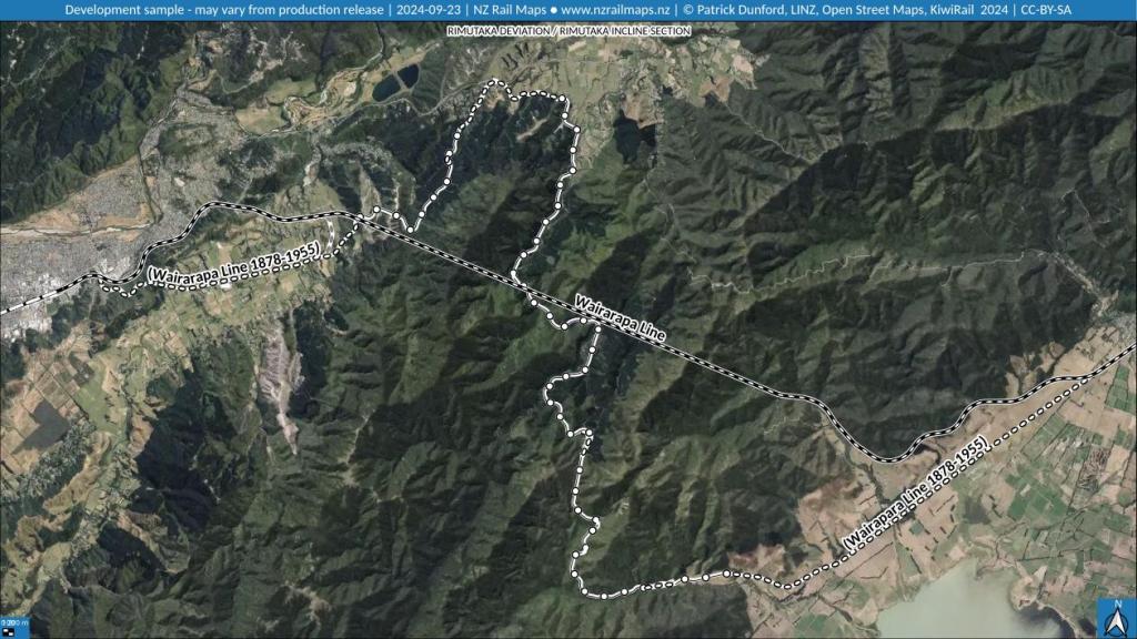
New Zealand Rail Maps: Rimutaka Deviation and Maymorn Station
The Rimutaka Deviation is a deviation of the Wairarapa Line that was built between 1948 and 1955 between Upper Hutt and Featherston. It replaced the section of track that contained the Rimutaka Incline. This section was opened in 1878 and closed in 1955. The maps below show the route in a simple route map form…
-
New Zealand Rail Maps: NZRM Volumes: Volume 10 (North Otago)
NZRM Volume 10 covers all railways in North Otago and part of South Canterbury on the East Coast of the South Island. There is approximately 500 km of mainline trackage within this volume. As at September 2024 only a part of Volume 10 has been fully mapped and this article will be updated as further…
-
New Zealand Rail Maps: NZRM Progress Report 2024-09-10: Volume 6, Volume 10, Webmaps
Although last month it was said the Volume 10 Dunedin-Mosgiel maps had been brought to a close, this has in fact only just happened. The delay was mostly due to the need to get the Volumes section of the NZRM website accessible again, which required the menu to be reinstated at the top of each…
-
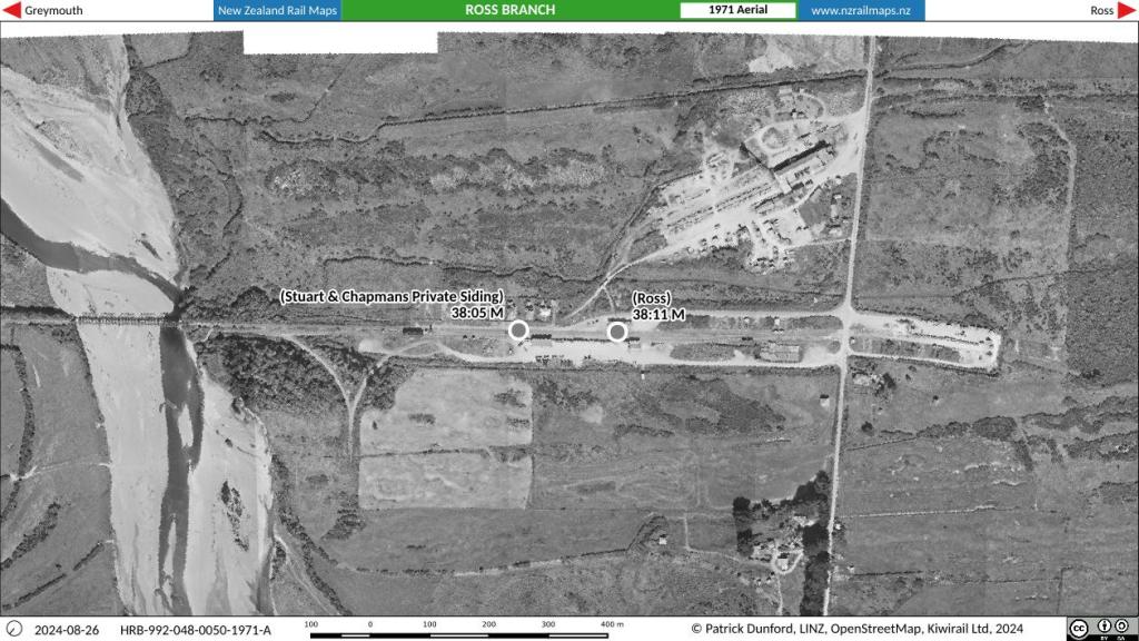
New Zealand Rail Maps: Ross Station, Ross Branch
As it may be known, the bridge at Ross crossing the Totara River, which still stands more than 40 years after the line closed, and which recently has been used by the West Coast Wilderness cycle trail, was recently closed due to safety concerns. The bridge has not been well maintained and may have to…
-
New Zealand Rail Maps: NZRM Progress Report 2024-08-18: Volume 10, Volume 12
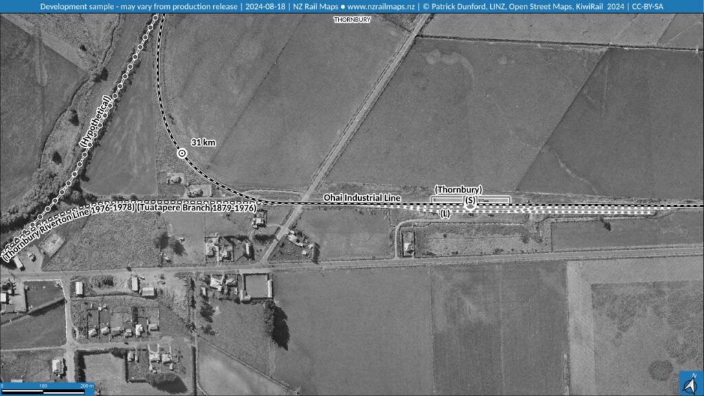
This month the work on Dunedin-Mosgiel maps in Volume 10 has been brought to a close, and a quick investigation has been done with sample maps for the Tuatapere-Orawia Branch. This Southland line originated at Makarewa (12 km north of Invercargill on the Kingston Branch) with the first 28 km to Riverton opened in 1879,…
-
New Zealand Rail Maps: NZRM Progress Report 2024-07-17: Volume 10
This month the work on Volume 10 specifically for Dunedin to Mosgiel is being brought to a close. Part of this work is to produce some historical maps for an article appearing in the NZ Railway Observer. At the same time a complete set of maps will be produced for the section which will be…
-
Christian Converser: New Blog Launched: neurodiverse.church
In association with CCNZ (this blog), a new blog is being launched called neurodiverse.church which will post commentary on issues relating specifically to neurodiversity in a church context. The last post published here was, of course, such a reference in itself, and posts from the new blog will automatically be syndicated to this one in…
-
Configuring Docks in Gimp by editing the sessionrc config file.
Anyone who has used Gimp is familiar with the use of the toolbox and the docks that appear on the screen. People naturally have their own preferences about how to arrange these user interface elements. I worked for a long time with screens in landscape mode, with a dock on each side of the screen.…